

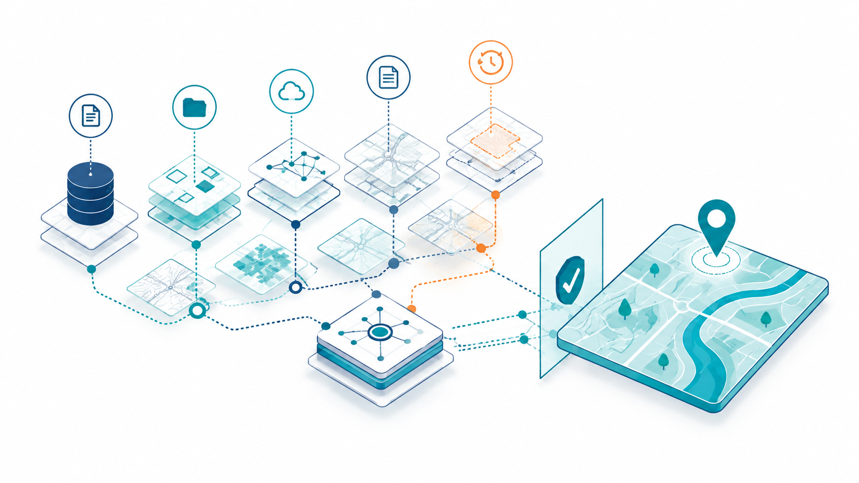
Your spatial data may be good, your metadata may be complete, and your GIS may work exactly as intended, but some of what makes that data trustworthy may still exist outside the data itself. It may live in the memory of experienced staff, old emails, project folders, naming conventions, or undocumented workflow habits. As long as the right people remain in the loop, that may not look like a problem. But as AI systems begin to discover, combine, interpret, and act on spatial data, that hidden dependency becomes harder to ignore.
Try asking a few questions about an important dataset. Where did it come from? What has changed? Why is this version authoritative? What did it supersede? What transformations or assumptions shaped it? Is it appropriate for the decision you are making?
Your organization may know the answers. The more revealing question is where those answers live. If understanding the dataset requires finding the right person, searching for old emails, or reconstructing its history from several systems and folders, part of your spatial data infrastructure may exist outside the data itself.
Good data and good metadata may not be enough
This isn’t necessarily a data-quality problem. A dataset can be accurate, current, complete, and accompanied by excellent metadata without preserving a complete account of how it reached its current state.
This is where provenance and lineage add something different. Provenance provides evidence about where information came from and the people, organizations, systems, and processes involved in producing it. Lineage helps reconstruct how that information moved and changed over time. These concepts predate modern AI. W3C formalized provenance as a web standard more than a decade ago, and recent geospatial research continues to distinguish conventional metadata from the machine-actionable provenance needed to reconstruct spatial data history.¹ ² ³
The practical issue is straightforward: clean data + good metadata does not necessarily equal decision-ready data. Understanding whether data is appropriate for a particular decision may also require evidence about its origin, history, transformations, authority, and limitations.
People have been part of the system
Experienced GIS professionals routinely supply that missing context. They know which dataset should actually be used, which fields haven’t been maintained, which boundaries were corrected, why one version superseded another, and which apparent anomaly reflects a deliberate decision.
That isn’t necessarily poor data management. People have historically been part of the practical information system. They recognize problems, remember previous decisions, understand local conventions, and supply context when needed. Research into organizational provenance practices has found that provenance can become less visible as data moves farther from the people and processes that produced it.⁴ Recent geospatial research similarly describes provenance information fragmented across metadata, workflow logs, and application-specific systems.²
The vulnerability appears when we mistake information known by the organization for information captured by the organization’s systems.
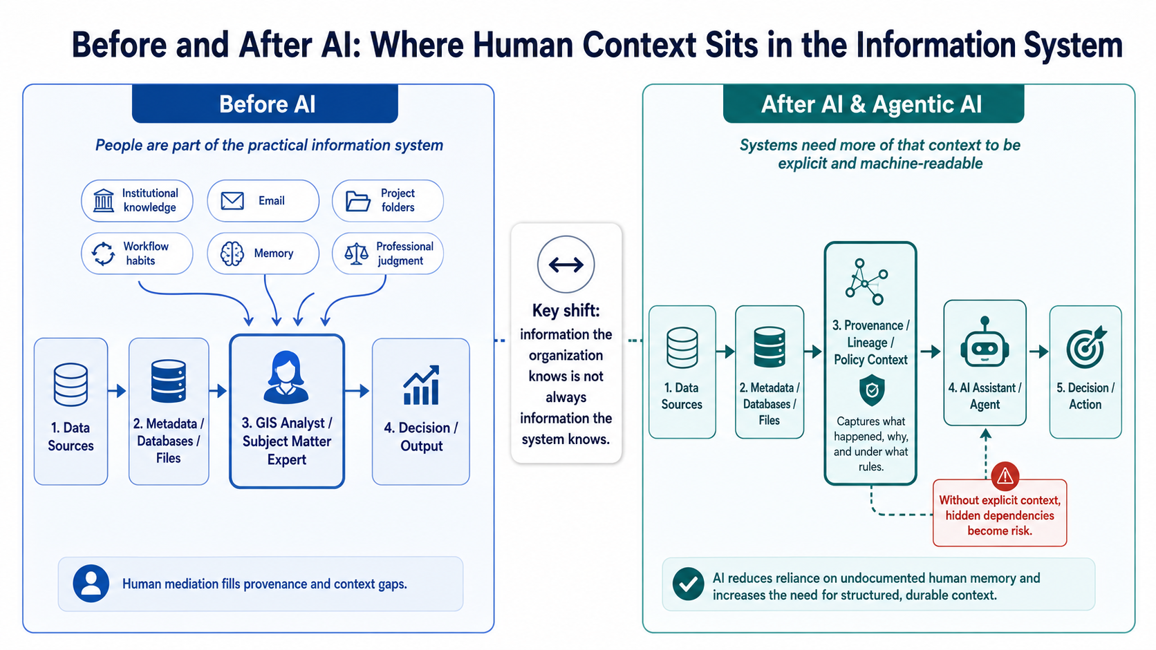
[FIGURE 1: Before and After AI — Where Human Context Sits in the Information System]
AI changes the equation
AI didn’t create this problem. It changes the architecture.
When an AI system begins discovering, selecting, combining, transforming, and interpreting spatial data, we can no longer assume that an experienced analyst will always be present to supply missing context. An AI system doesn’t automatically know that a layer hasn’t been maintained since a migration, that one source is preferred despite another being labeled “official,” or that a methodology change affects whether a dataset is suitable for a particular use.
Agentic AI raises the stakes further because systems are beginning to perform sequences of actions with less direct human involvement. Emerging research is already extending provenance concepts beyond the data itself to trace the inputs, interactions, and actions involved in agentic workflows.⁵
The shift can be summarized simply:
Information your organization knows is not necessarily information your systems know.
As machines take on more of the work of finding, interpreting, combining, and acting on spatial information, more of the context that people once supplied informally needs to become durable, accessible, and machine-readable.
Do you have the problem?
There is a simple way to find out. Pick one important spatial dataset and ask someone other than its normal custodian to reconstruct its origin, changes, transformations, validation, authority, and limitations using only your organization’s systems and records.
Where the answers come from tells you something important about your actual spatial data infrastructure.
If those answers are available from durable records associated with the data, much of the context needed to understand it has been preserved. If the exercise requires searching emails, interpreting file names, exploring old folders, or finding someone who remembers what happened, you have identified a hidden provenance dependency.
Your GIS can still work. Your data can still be good. Your metadata can still be excellent. The issue is whether the evidence needed to understand and appropriately use that data travels with it.
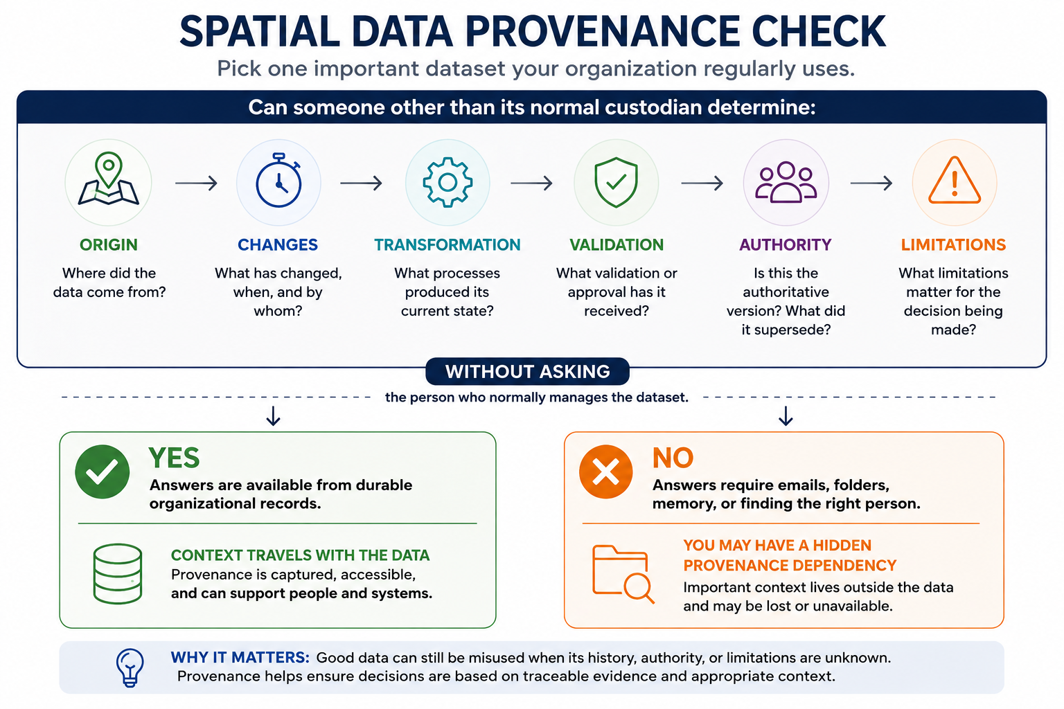
[FIGURE 2: Spatial Data Provenance Check]
The spatial data problem you may not know you have isn’t necessarily that your data is wrong. It’s that some of what makes your data trustworthy may exist outside the data itself.
This is the problem space that led us to build Attashe, a product of Trident Spatial Labs: making origin, lineage, change history, validation, and authoritative versions durable parts of spatial data infrastructure rather than context that must be reconstructed later.
References
- World Wide Web Consortium (W3C). PROV Overview. 2013. https://www.w3.org/TR/prov-overview/
- Sadiq, M. A., Langat, P. K., & Neupane, A. Enterprise Spatial Data Provenance Knowledge Infrastructure. ISPRS International Journal of Geo-Information, 15(5), 182, 2026. https://www.mdpi.com/2220-9964/15/5/182
- Sadiq, M. A., Langat, P. K., & Neupane, A. GeoPROV: A Domain-Specialised Provenance Model for Spatial Data Supply Chains. ISPRS International Journal of Geo-Information, 15(6), 272, 2026. https://www.mdpi.com/2220-9964/15/6/272
- Goswami, S. Data Provenance in Practice – A Case Study in Banking and Finance Sector. ECIS 2026 Proceedings, 2026. https://aisel.aisnet.org/ecis2026/datasc_isresearch/datasc_isresearch/1/
- Souza et al. PROV-AGENT: Unified Provenance for Tracking AI Agent Interactions in Agentic Workflows. 2025. https://arxiv.org/abs/2508.02866